Alsara took a lot of work.
It seems like a strange thing to say for a personal project, and it never felt like work at the time. But the truth is, I've been building this thing for four years now, and poured a lot of my expertise into making it. In a way, my work on Alsara has shaped me, almost as much as it has been shaped by me.
This document is a record of how some of it came to be.
This document is a record of how some of it came to be.
The World Map
Why and How it Came to Be
The world map of Alsara has been a major focus of mine in the last year or so, culminating in a great deal of progress in the last three months. Now, it's gorgeous, and I've got a big poster sitting in my living room almost as big as a person. Glorious.
It didn't start out that way, of course. There was a long process in building that map into what it became.
This is how the map looked in the beginning:
It didn't start out that way, of course. There was a long process in building that map into what it became.
This is how the map looked in the beginning:
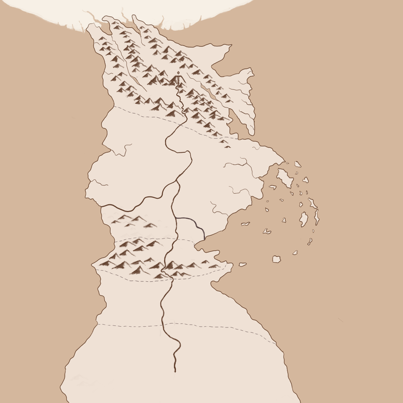
Early Alsara Map
It wasn't bad. It also wasn't made by me.
I have very few artistic talents, and I was reliant on the abilities of my friends to produce all concepts. As a result, I gave my friends a lot of artistic license to build how they felt like they should. The builder of this map was a very old friend named Isaiah Baden-Payne, who is also a specialist in history and anthropology.
Isaiah's contributions to the shape of this map are important. I gave him a rough description of the countries, about like so:
- The northern country is very mountainous
- The middle country is very large
- There is an island chain off to the east
- Below the middle country is a thin part that is also mountainous
- Then to the south is a bunch of desert and stuff
- There is a big physically impossible river that runs from north to south
Main Lessons from the Historian on Maps
1: Rivers are Not Straight
|
He and I fought forever over the Great River. I knew very little about geography and the physics of weather at the time, and he gave me a crash course in how this is done.
During that time, he pointed me to great world-building tutorials like the one present here, by Order of the Stick creator Rich Burlew. They would prove an invaluable resource for my eventual reconstruction of the map. I decided to try and find the ways such a river could exist, and how the magic present in it would impact the countries it affected. The river itself remains. |
4: When Building Coastlines, Add Bays |
According to Isaiah, many--if not most--great naval battles have occurred when it is faster to go by sea than to go by land, or when it is impossible to go by land at all.
By that logic, creating many places where it is faster to go by sea--places like the Mediterranean, the Caribbean, and the English Channel--will encourage lots of delicious naval conflicts, and builds up the idea of a country being influenced, even reliant, on naval power. |
This is important for the humble D&D player because they need a reason for dashing high-seas adventure. In addition, boats are only surpassed by spaceships and airships as effective "bases of operation;" a consistent headquarters for a party to store their things, to upgrade, to retreat to if things go sour. There are entire RPG systems that rely on a ship (whether it travels over air, sea, or space) being a central focal point for the entire campaign.
To create a world where the campaign can be on a boat, there needs to be things for the boats to do, and places for boats to go. Thus, thick rivers, and inland seas. I had already structured much of Alsara before I'd learned this lesson, and could only make small changes to try and encourage it. I remembered this lesson when I began work on the Reaping Realms.
To create a world where the campaign can be on a boat, there needs to be things for the boats to do, and places for boats to go. Thus, thick rivers, and inland seas. I had already structured much of Alsara before I'd learned this lesson, and could only make small changes to try and encourage it. I remembered this lesson when I began work on the Reaping Realms.
5: Mountains Come in Lines
|
It seems like a simple lesson to learn, but somehow I never really noticed how mountains worked. I had always imagined them in grouped areas, where the tallness got really tall. But in a macro scale, it becomes extremely obvious that mountains mark the edges of tectonic plates, and rarely just happened for no reason.
Islands, as it so happens, often come from the same phenomenon. As a result, they usually come in whispy lines and rows. This would end up strongly influencing how I would redraw the map. |
I would end up using that map for many years; but not forever.
What Changed
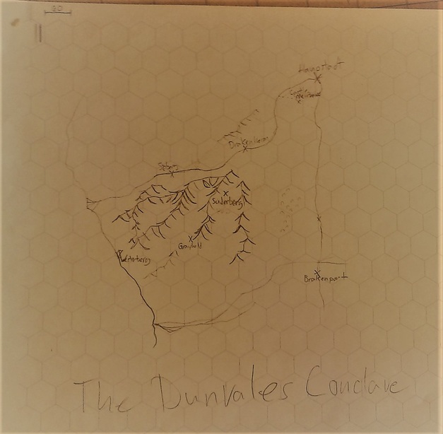
Eventually, I drew this picture:
A map. Hand-drawn, by me, for practical use.
This map was a small region in Alsara known as the Highhorn Plateau. As might have been mentioned earlier, this universe was designed from the ground up to fit into the Dungeons & Dragons RPG systems and their derivatives, and so there are a lot of practical opportunities to use these maps. This particular map was the stomping grounds of a party for several months of an ongoing campaign, and they travelled up and down it a great deal.
There are two major things that I learned as a result of this map:
Hexes and Distances |
The hexes are vital and inextricable, and there's a scale in the upper corner. The amount of time the party spent getting from place to place was vital to the plot, and I found it beyond useful to have a map I could consistently call upon to mark the time it took them to travel. The hexes made that possible.
|
Discovery of Terrain Features |
Second, you'll notice it's covered in writing. You might not be able to read it (apologies for the poor quality of my phone's camera), but those words are the names of towns and inns along the way. This map forced me to put names to over a dozen locations that had previously been mysterious.
|
Those two things were really important, and I enjoyed them more and more. The ball had begun to roll.
The Charting of the World
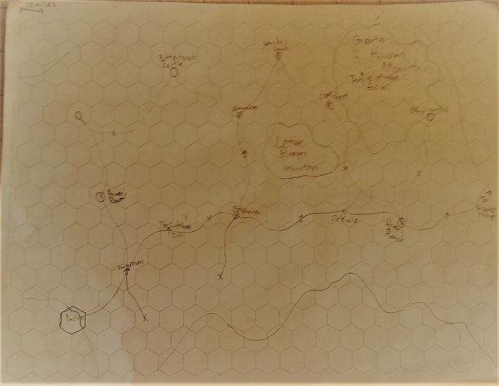
Not long after that, I set out to draw a 60-mile hex grid map of the whole world, allowing me to know--not approximate, but know--where everything was in the world. Not out of just fun, but out of necessity as well. The first piece was this:
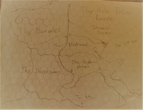
A simple zoom-out, trying to chart the nearby regions. I hadn't learned the techniques for mapping mountains properly yet, and thus they are simply marked by the area they supposedly took up. This was not so helpful in the end.
I did, however, manage to place definitively the locations of several places that had once been vague. I also named the mountain range, which I hadn't done previously; it hadn't occurred to me until I saw its size and scale on the map. Clearly, it would have been named.
I had confirmed that drawing a map was an invaluable resource for defining the world in all terms. I would, in future, map every world, and would consider any design merely a draft until I had done so.
The next map I assembled was a region just north of it:
I watched this video series on map making, improving my technique, and finally picked up a better way to draw mountains. I also experimented with lower hills off to the right, but was unsatisfied with the result; I give up on them until later.
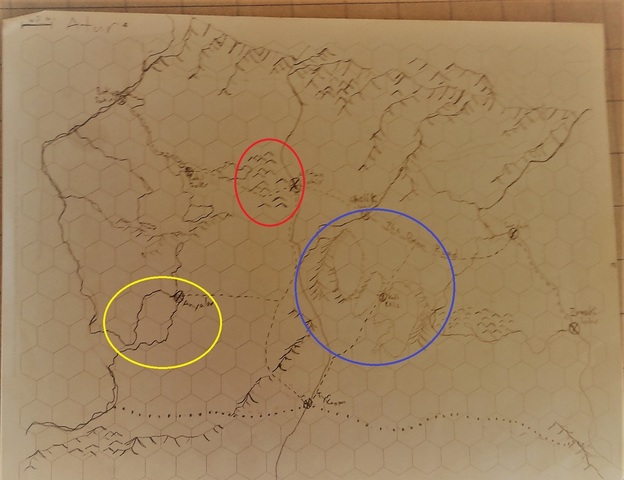
Another region to the south. This map was drawn in two stages, and contains some of my more advanced techniques that I learned after much of the map was finished.
The red circle indicates the hill technique I found to be time-consuming but effective and appealing.
The blue circle is a trio of plateaus. The style didn't match the mountains well, and weren't very able to communicate the idea of a flat region effectively. However, I didn't get many future opportunities to improve the technique, so it remains.
The yellow area indicates one of the first regions where I intentionally created bays by carving out sections of land, in reflection of the idea that such locations created more visual and cultural activity. It was a small nod in that direction in this case, but it also influenced future works.
After drawing this map, I got an idea.
|
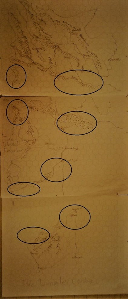
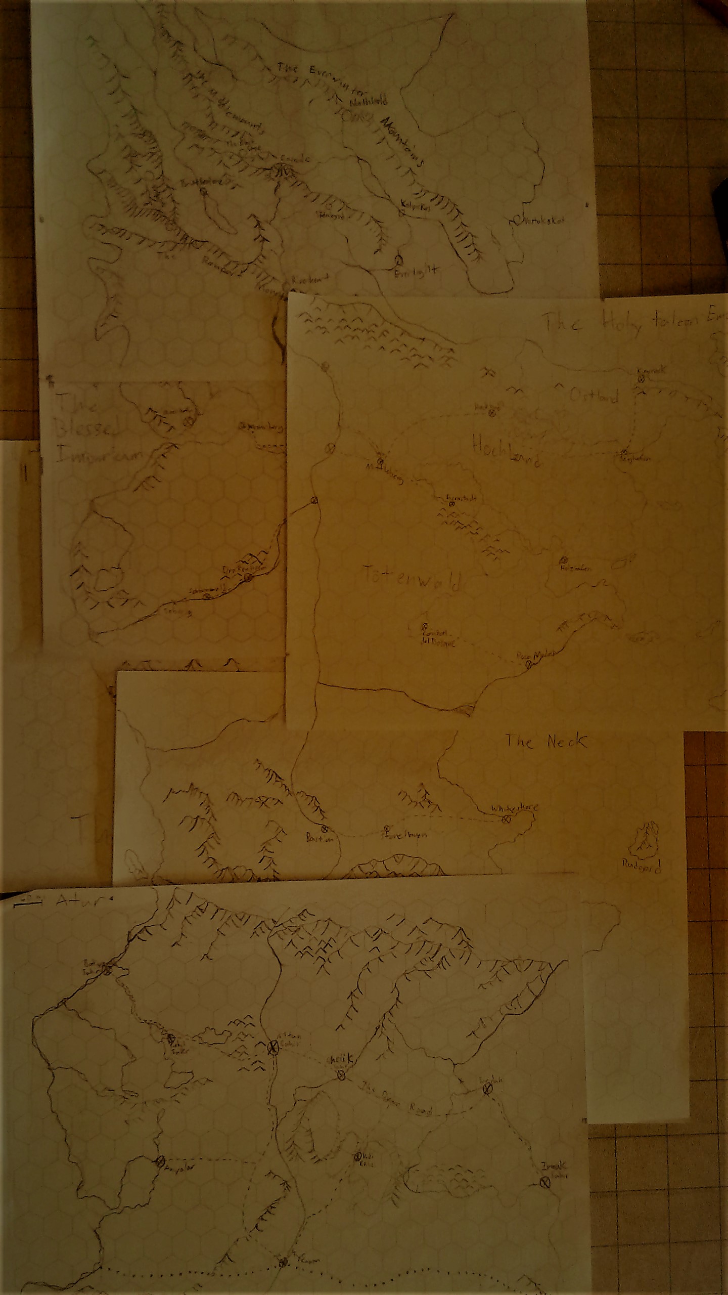
I began working on assembling the maps so that they weren't independent of each other. By tracing through the pages using the coasts and mountain ranges, I would create maps that would line up perfectly in set locations. The circled areas are good examples of where the maps connected.
As a result, I would create a consistent map structure connecting the whole world, top to bottom. I could overlay the maps and construct a contiguous landmass, calculating distances accordingly. The advantages for this are obvious, though there were disadvantages with this technique as well. I realized, especially after I moved on to the next stage of the map's creation, that the piecemeal approach to constructing the world blinded me to large-scale trends in the continent. In other words, I lost sight of the big picture. As a result of that, I had some repeating trends (like my experimental inlets and bays) that would have looked good had they been isolated, but I found were distressingly strange when in the numbers I'd made them. I also had intended one of the regions to serve as a tight choke point, which wound up much wider than I'd intended. The world's vertical bias started to bother me where it had once been intentional, primarily because the western coast was so straight while the eastern one remained appropriately rough. All of these were issues that were uncomfortable, but not so much that it was worth rethinking the entire project. They were minimized where possible then left as they were. I was consoled by the fact that, when I checked against Google Earth, I quickly realized: when it comes to the shapes of landmass, anything goes. |
|
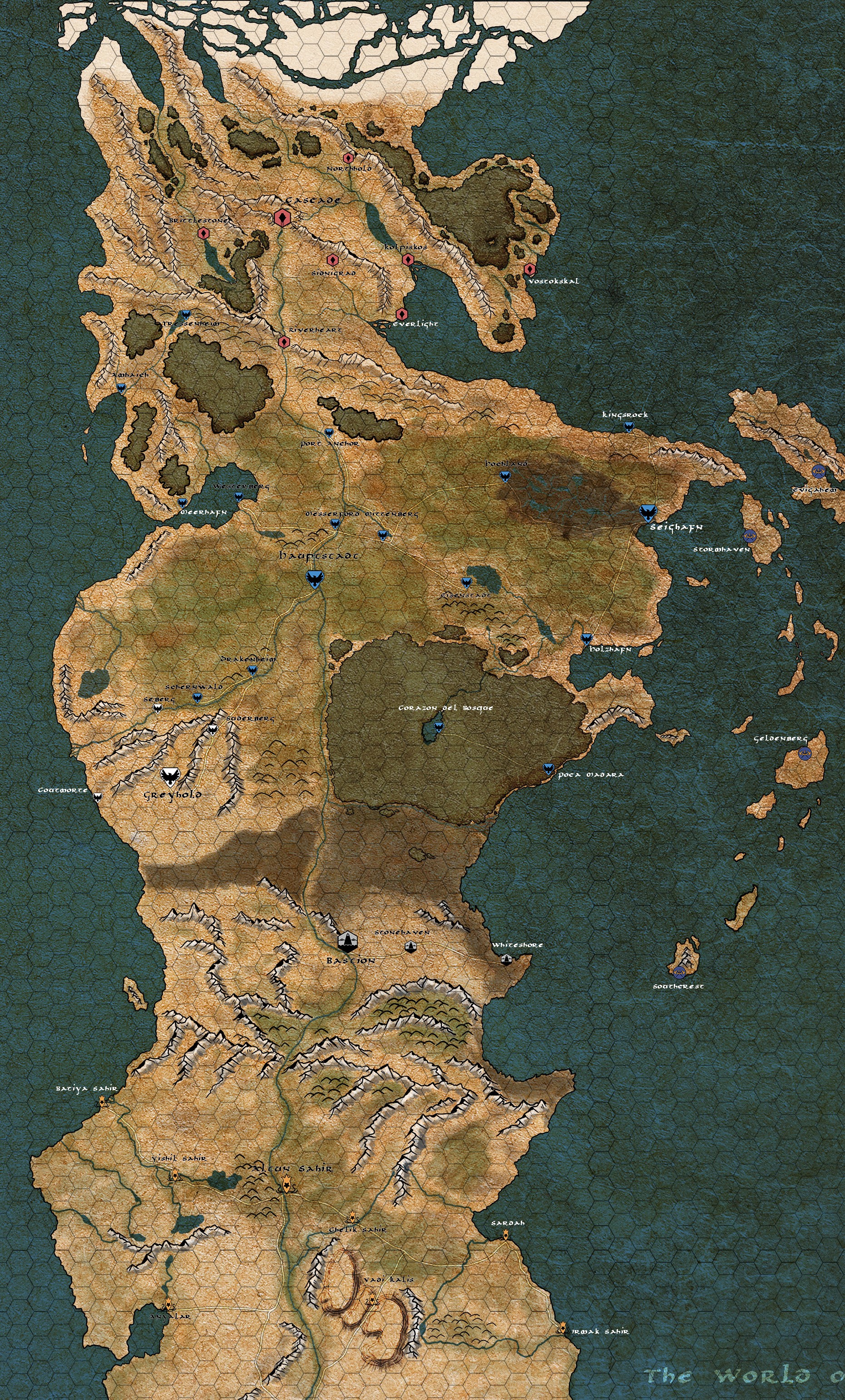
The result was a big map, that covered nearly every inch of the world. And that big map created an awesome possibility.
At this point, further progress alone was impossible. I was finished with technical drawings, I could run the world at that point without much effort. In order to move further, to make it really nice and to compile it into a single document, I needed a friend.
An artist friend.
That friend was Sarah McGinley, who I worked with for about a month. We would confer often, usually working in the same space at the same time, as we toiled together to clarify some of the mistakes.
|
In the end, we turned this...
|
...into this.
|
|
|
I took that beautiful beast, I printed it out at a print shop, framed it, and then I hung it on my wall.
Complete with hexes and glass-friendly markers, for maximum practicality.
Complete with hexes and glass-friendly markers, for maximum practicality.
Cities
Building a Metropolis
In this setting, in the course of mapping things, I have learned a great deal about cities. These are two great examples, though I've made more:
|
The Final Image
|
My Notes
|
There are several important challenges that we (myself and the artist) overcame in our quest to get these maps to look as good as they do, not to mention the practical applications of the resulting art.
How to Build a City
Before pen ever touches paper, I learned that there are some questions that must be answered.
Why does this city exist? |
Cities occur at confluences of trade routes, which are roads and water access. Both also can serve as defensive strongholds, or places that require defensive strongholds. If the city is responsible for the production of a major raw or refined material, that should be noted as well.
|
Who lives here? |
Cultural backgrounds will influence the layout and the governance of a city. One culture has invented sewers and has a separate district for foreigners. One cultre has poor city planning and cheap land, leading to sprawling estates within the city limits. One nation has such a massive wealth gap that there are more walls within the city than without, to keep the rioting peasants and slaves under control
|
Where did they build it? |
General terrain features, as well as major structures. Is there a castle present? Is it a port? Are there major elevation changes?
|
How many people live here? |
This is a complicated question, however as I was building in Alsara I already knew the approximate populations of every single major city in the world. How did I know that? Well, I didn't just make it up.
While I was drawing the world map, I also used this awesome site to calculate exactly how many people lived in each country. Once I'd done that, I was able to calculate how many major cities of at least 8,000 people were present (and all of their names, while I was at it.) Yet another reason to map a world to 60-mile hexes. |
And lastly, my personal favorite,
Did they do anything crazy? |
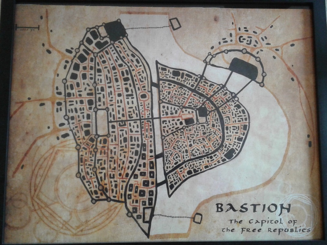
Sometimes this can be something simple; for example, the city of Bastion above has a trio of huge bridges that extend to the opposite cliff.
However, other cities are much more dramatic. Several cities in Alsara can fly, or have sections that are technically not on the ground. Others are built on or around massive pyramid-sized monuments. One is built into a cliff, and another was so swampy about half of it was just constructed over water. For obvious reasons, I have to keep these in mind. |
Once I've done that, then it's time for the districts.
The 3.5 edition of Dungeons and Dragons released an expansion book called Cityscape, and of all the books Wizards of the Coast released (which must have numbered over a hundred), this book has endured on my shelf the longest. The reason for this is one simple chapter: City Districts.
Districts are the organs of a city, its every part, and the book describes a couple of dozen example districts for use. Each district is broken into what types of structures can be found there, and in what percentages. This also includes the district's overall density, as a large percentage of parks or upper class housing tends to include a lot of empty space. I use the book's example districts so that I don't forget vital parts of a city that might otherwise go overlooked, and so it can suggest to me just what kinds of areas a district might represent. How many temples? How much of this lower residential district is shantytown, and how much is cramped apartments? Are there still any taverns or inns at all in this area? Do they have access to any kind of sewer system?
|
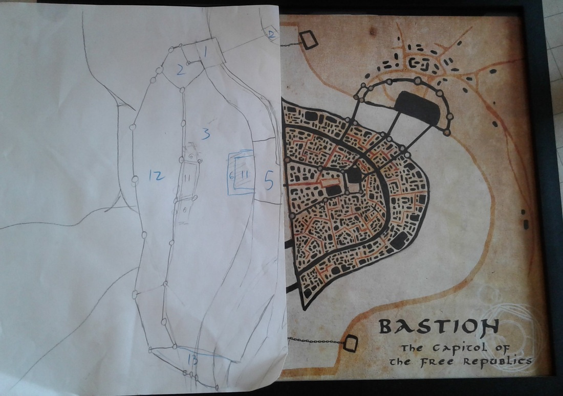
Once I'd figured out the basic attributes of a city, I'd begin construction of a map, like the one on the right or the two up above.
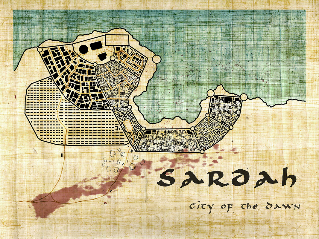
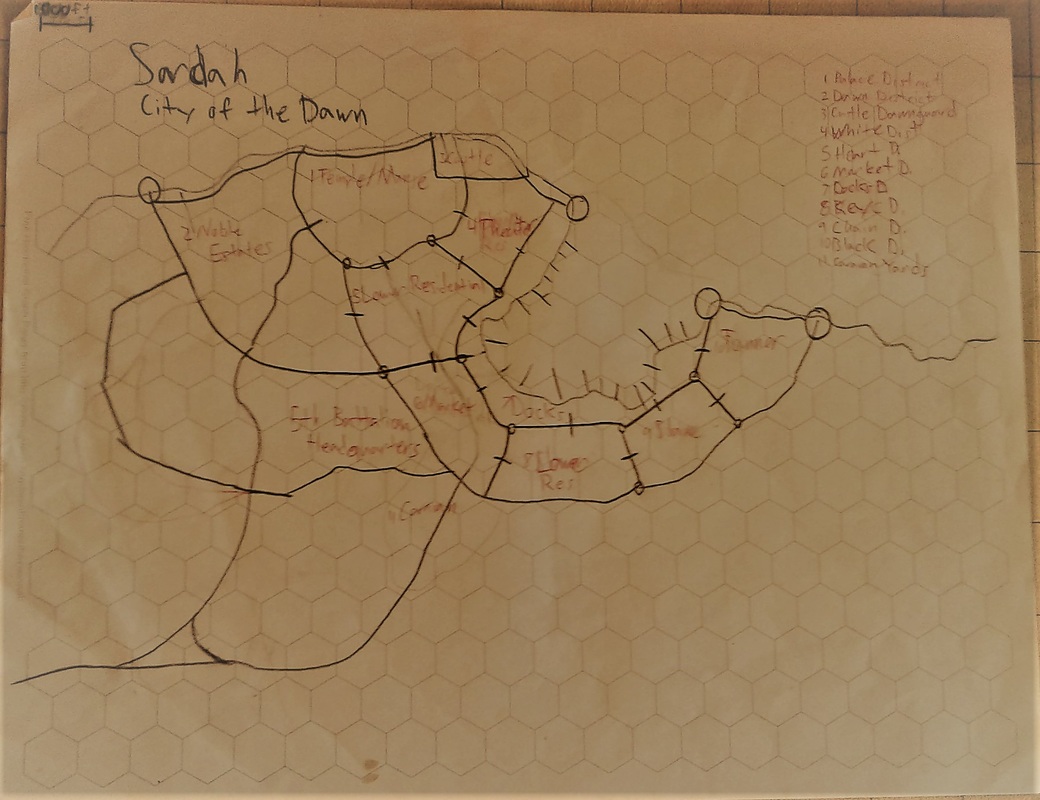
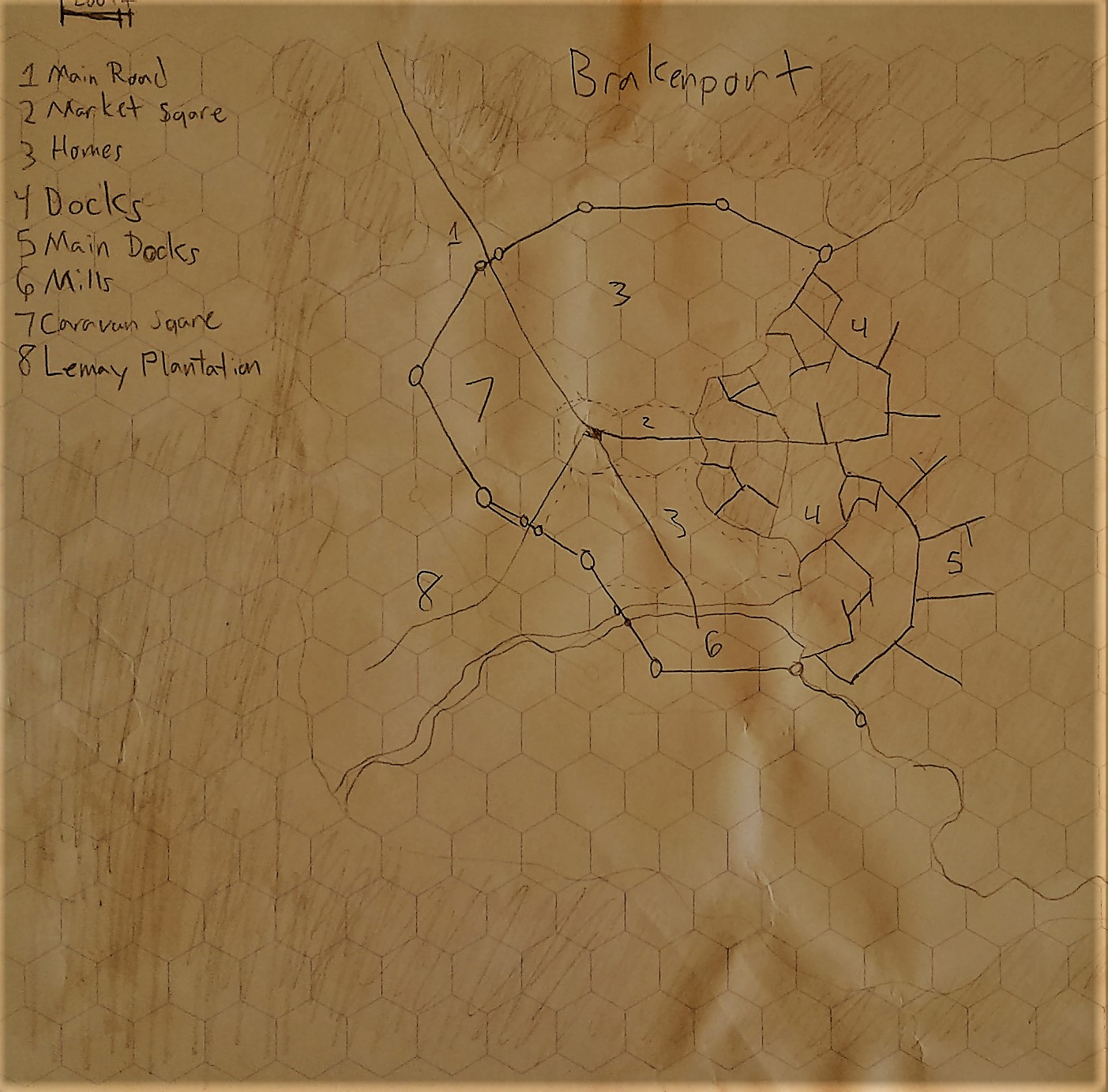
It begins with the roads, as they are usually the arteries on which the city was built in the first place. From there, I begin with the most vital districts (civic, docks, any major landmark districts, market squares, castles) and add on to the sides, or subdivide existing districts to add nuance. Other times, especially in heavily fortified cities like Brakenport, I'll begin with the city walls and fill inwards, much like the city itself might have been forced to do. I then number the districts, and both identify their type and give them a name. This is most clear in the Sardah map. The type of district marks the kind of buildings and their density, and the name is how the people of the city itself would refer to it. For the most part, I use the district's name alone from that point forward, but there is one major exception. |
|
Making them Beautiful
I actually began my working relationship with Sarah McGinley (the artist who would end up making the gorgeous world map from earlier) by making cities. We would sit down together in the same space, and we would collaborate on the translation of my notes into a beautiful cityscape. She did most of the work, though I was careful to be on-hand to answer questions.
It was at this stage that the district types and densities really came into play. By using the suggestions in the books, we were able to identify major structures that would appear on a map scale, determine the organization of the city streets (if any), and figure out the size of the buildings and how much space they had between them.
It was an invaluable tool, and the results were spectacular.
Making History
The foundations of the Cultures and Kingdoms of Alsara
Alsara wasn't built in a day.
It was built piece by piece, over years of time. The origins for this setting (and the name) come from one of the first ever D&D campaigns I played in, though its current resemblance to that ancient game is nearly nonexistent. The real work began around 4 years ago, and it began by assembling everything I thought I knew about the world of Alsara. It could have fit in a thimble.
The Power of Source Materials
I was not at a loss for resources, however. I was a huge fan of Crash Course World History, which then led me down a path of primary sources, passionate study, and a general overall interest in the history of the world. I used what I learned as a touchstone; it would justify decisions about cultures, technologies, beliefs, religions, and the history of my own world. The rule was, if I couldn't think of a reason that a given facet of Alsara didn't reflect our own world, then it should reflect our own world.
That sounds like a pain, but the truth is, it was glorious. By using Earth as a baseline, there became a place I could go to do research into my own setting. Details were always available; lots, and lots, and lots of details. After finding my sources, what I found next was the tone.
The thematic tone of Alsara is influenced by lots of sources, some of the main sources were the The Witcher and Dragon Age games, as well as fantasy novels like A Song of Ice and Fire, Abhorsen, The Kingkiller Chronicles, and The Black Company. They all weave together a vision of a dirty and cynical world, that is nevertheless perpetually showing virtue and honesty beneath its veneer. Humanity, in its totality, would be captured: the humanity capable of grace, the humanity capable of genocide, and the casual humanity that is just afraid of what it doesn't know.
The building blocks were in place. Now, it was time to sit down and write.
In the Beginning
History was not built in chronological order.
Weirdly enough, when doing work on fantasy worlds I usually start in the present day, and find the things that I want to exist. That process is a mess, and generally looks like a big brainstorm document; or it would, if I wrote it down, but usually things go so fast when I'm working on big concepts that it either comes out in conversation or happens in my head.
Weirdly enough, when doing work on fantasy worlds I usually start in the present day, and find the things that I want to exist. That process is a mess, and generally looks like a big brainstorm document; or it would, if I wrote it down, but usually things go so fast when I'm working on big concepts that it either comes out in conversation or happens in my head.
Building Blocks |
I already had some of the work done for me: the world was originally based on a D&D campaign that I'd played in high school. From it, I pulled some major worldbuilding strokes and the four main kingdoms (which was quickly pared down to three): one that ran on magic, one that ran on feudalism, and one that ran on money.
|
Next Steps |
I wanted to match these kingdoms to real-world regions, where I could draw major cultural markers and select languages. I chose for the magical kingdom to be Greek/Russian, the feudal kingdom to be German/French, and the money kingdom to be Persian/American. This all matched up with the generally eurocentric world that D&D provides for.
|
Questions and Answers
|
I had the basics in place, but not a world yet.
At this point I created the Obsidian Portal, and the wiki inside it. On that wiki I made a page for every kingdom, and went about answering the questions on the right. |
|
The Past, Present, and Future
While I was forming these cultures, I was also figuring out their histories, and how they got to where they were. There was a lot of bouncing back and forth, as my general theme fed into my history, which modified the present in each of the kingdoms, then another question would be answered, and I'd bounce back into history, which would echo back to the present...and so on. I felt like a 3D printer, jumping around all over a shape to articulate tiny details, working everywhere at once.
Well, in slow motion perhaps. This project went on for years; heck, I'm still developing empty sections of history, using them to fill out laregly unknown portions of the world today. The campaigns I run in the setting force me to focus in on regions I've neglected, as both my own eyes and those of my players move through and search for detail in the places I'd never addressed. At the same time, I use the actions of the players to fuel the future of the setting, letting their own deeds echo throughout history. The world was never a static thing, but living, and constantly shifting based on the actions of the many, and of the few.
Well, in slow motion perhaps. This project went on for years; heck, I'm still developing empty sections of history, using them to fill out laregly unknown portions of the world today. The campaigns I run in the setting force me to focus in on regions I've neglected, as both my own eyes and those of my players move through and search for detail in the places I'd never addressed. At the same time, I use the actions of the players to fuel the future of the setting, letting their own deeds echo throughout history. The world was never a static thing, but living, and constantly shifting based on the actions of the many, and of the few.
